. Field notes from Western North Carolina
Asheville guides, walked before they were written
Trail reports, garden guides, taprooms, campgrounds and road status for Asheville, Brevard, Hendersonville and the Pisgah country around them. Every page carries the date we last stood there.
Conditions right now
Weather data from Open-Meteo
- Asheville 2,134 ft –
- Brevard 2,230 ft –
- Hendersonville 2,146 ft –
Checked
Right now in the mountains
Not a news feed. These are the handful of closures, reopenings and seasonal windows that will change how you plan a week here.
Luminere is on at Biltmore
Biltmore's evening light show runs select nights through October 18. On event nights the garden roads close to cars at 7 p.m. and garden hours can end early, so check the calendar for your date.
Plan the gardens →Davidson River Campground, September 1
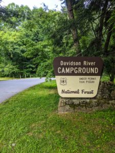
Still closed for a ground-up rebuild. We walked the fence line in June and the roofs are on. Treat September 1 as the target rather than the guarantee, and hold a backup site.
Read the field report →Parkway open south to Mount Mitchell
The Blue Ridge Parkway runs from Asheville at milepost 382 down to 355.3 for Mount Mitchell. North toward Little Switzerland is still closed, and NC 80 with it. Expect a 35 mph limit and construction traffic.
Hike the summit →Roses, tubing weather and clear water
Biltmore's Rose Garden peaks June through September and the Davidson River is running warm and clear. Go early. The popular put-ins and swimming holes fill by mid-morning on weekends.
Float the Davidson →Field guides
Start with these four
The pages we send people to most often. Each one was walked, timed and photographed by us, then checked again before it went live.
Biltmore EstateWalked July 202625 to 35 minutes inside
The Biltmore Conservatory, room by room
No separate ticket, no timed entry, and the best restroom on the estate. We walked every room of the 1895 greenhouse and mapped the two side corridors that almost everybody misses.
Read the guide →
Pisgah National Forest3 runs mapped
Tubing the Davidson River
Three floats, from a one-mile family lap you can walk back and repeat, to a six-mile drift that needs a shuttle driver. Where to put in, where to pull out, and which bridge means you went too far.
Read the guide →
Biltmore EstateUpdated 202613 locations
Proposing at Biltmore Estate
Which ticket you actually need, the parking lot the attendants will try to talk you out of, thirteen spots ranked by privacy and light, and what to do when the forecast turns.
Read the guide →Asheville to BrevardPolicies checked July 2026
Dog-friendly breweries near Asheville
Patio only, taproom only, or anywhere in the building. We checked every one from downtown out to Mills River, Brevard, Hendersonville and Fairview, and wrote down exactly where your dog can stand.
Read the guide →Trip planning
How many days do you have?
The mountains are bigger than most people budget for. Mount Mitchell is an hour from downtown on a good day. Here is what actually fits.
One day in Asheville
Pick a single anchor and stay near it. Trying to add the Parkway to a Biltmore day is how people end up eating dinner at nine.
- Morning at the Biltmore gardens and Conservatory
- Late lunch in Biltmore Village or the River Arts District
- Afternoon at a downtown taproom
- Sunset from the Parkway overlooks south of town
A long weekend
Enough to split your time between the city and the forest. Give one full day to Pisgah and do not schedule anything tight after it.
- Day one: Biltmore, then downtown
- Day two: Pisgah, with waterfalls and a swimming hole
- Day three: Mount Mitchell and the Parkway
- Evenings: barbecue and the brewery circuit
A full week
Now you can reach the places worth the drive, and still keep two slow mornings. Move your base halfway through if you can.
- Add Max Patch for sunrise or sunset
- Add wine country and an unhurried tasting day
- Add Pink Beds or a longer Pisgah loop
- Add a night outside
Where to stay
Where to base yourself
Almost everyone books downtown Asheville by default. Depending on what you came for, one of the other three may put you thirty minutes closer to it every single morning.
Buncombe County
Asheville
Book here for restaurants, breweries, live music and the Biltmore Estate. It is the busiest and priciest option, and parking downtown takes real patience on a weekend.
- Best for
- Food, beer, Biltmore
- To Pisgah
- 45 min
- To Mount Mitchell
- 60 min
Transylvania County
Brevard
The gateway to Pisgah and the Land of Waterfalls. A walkable Main Street with a six-block social district, and you can be at a trailhead in ten minutes instead of an hour.
- Best for
- Waterfalls, hiking
- To Pisgah gate
- 10 min
- To Asheville
- 45 min
Henderson County
Hendersonville
Quieter, cheaper, and about twenty-five minutes south of Asheville on I-26. Apple orchards, a walkable downtown, and easy reach of both the city and the forest.
- Best for
- Value, orchards
- To Asheville
- 25 min
- To Brevard
- 25 min
Buncombe County
Black Mountain
Small, calm, and the closest base to Mount Mitchell. Good if you want mountain-town evenings without downtown Asheville crowds, and you plan to spend your days east.
- Best for
- Quiet, Mitchell access
- To Asheville
- 20 min
- To Mount Mitchell
- 50 min
When to come
The best time to visit Asheville
There is no bad season here, only seasons that suit different trips. Elevation does most of the work: the summit of Mount Mitchell runs 15 to 20 degrees colder than downtown on the same afternoon.
Spring
March to May
Tulips at Biltmore, then azaleas, then rhododendron working up the mountain by elevation. Trails are quiet and green. Bring rain gear and expect the high country to run a few weeks behind town.
Summer
June to August
Peak season for water. Tubing, swimming holes and waterfalls are at their best, and the high balds stay cool while town gets sticky. Popular trailheads fill by nine on weekends.
Fall
September to November
The busiest and most beautiful stretch. Color starts above 5,000 feet in early October and reaches town by late in the month. Book lodging months out and drive the Parkway on a weekday.
Winter
December to February
Cheapest, emptiest and underrated. Bare trees open views that summer hides, waterfalls run hard, and the Biltmore Conservatory is at peak orchid season. Check road status before every high-elevation drive.
Logistics
Getting here and getting around
-
Flying in
Asheville Regional Airport sits about fifteen minutes south of downtown and five minutes from Mills River. It is small and easy. Charlotte and Greenville-Spartanburg are the usual alternatives when fares are better, at roughly two hours and one hour of driving.
-
You will want a car
Downtown Asheville is walkable and there is a city bus, but nothing that gets you to a trailhead. Every guide on this site assumes you are driving. Cell service drops out in Pisgah and on much of the Parkway, so download your maps before you leave the hotel.
-
The Blue Ridge Parkway is not a shortcut
The speed limit is 45 mph and lower in the construction zones. It is a scenic route, not a route. Sections still close for weather, rockfall and Helene repairs, so check the official road status the morning you go rather than trusting a mapping app.
-
Fuel and food thin out fast
There are no gas stations between Asheville and the Mount Mitchell summit, and none inside Pisgah. Fill up in town, pack water, and do not count on a restaurant being open in a small mountain town after eight on a weeknight.
Pick a direction
What do you want today to look like?
A hike
Grassy balds with views in every direction, spruce-fir forest at 6,600 feet, and flat bog loops for slower days.
TrailsCold water
Swimming holes, waterfalls and tubing runs in some of the cleanest water in Western North Carolina.
Falls and swimmingSomething to eat
Barbecue, taprooms and the places locals actually go, plus honest notes on the ones they skip.
Food and drinkThe Biltmore Estate
Tickets, parking, the gardens, and the difference between the Conservatory and the Winter Garden.
The estateA slow afternoon
Estate vineyards, mountain tasting rooms, and tours that will drive you between them.
Wine countryA night outside
Campground reports written on site, plus the RV parks we point people to when the good ones are full.
CampingThe rest of it
Every guide in one list
Fast answers
Asheville trip planning questions
What is the best month to visit Asheville?
October is the most popular and the most crowded, because leaf color moves down the mountains through the month. For fewer people and lower prices with most things still open, aim for late April into May, or the first half of September. Winter is the cheapest and quietest, and the views through bare trees are better than most visitors expect.
How many days do you need in Asheville?
Three days is the practical minimum if you want both the city and the mountains. One day forces you to pick a single anchor, usually Biltmore. A full week lets you reach Max Patch, Cataloochee and the longer Pisgah loops without a punishing drive each morning.
Do I need a car in Asheville?
Yes, for almost any trip that includes the outdoors. Downtown is walkable and there is a city bus, but no public transport reaches a trailhead, the Parkway, or most of the breweries outside the city. Cell service is unreliable in Pisgah, so download offline maps before you set out.
Is the Blue Ridge Parkway open near Asheville?
As of mid-2026 the Parkway is open from Asheville at milepost 382 south to 355.3, which is the turn for Mount Mitchell. North of the park toward Little Switzerland remains closed for Helene repairs, and NC 80 is closed with it. Full reopening is targeted for late 2026. Check the National Park Service road status on the morning you travel.
How far is Asheville from Mount Mitchell?
About an hour of driving to the summit parking area, going south on the Parkway from milepost 382 to 355.3 and then up NC 128. There are no gas stations along that stretch, so fill up in town. Summit temperatures run 15 to 20 degrees colder than Asheville, and the wind can be sharp even in July.
Should I stay in Asheville, Brevard or Hendersonville?
Asheville for restaurants, breweries and Biltmore. Brevard if waterfalls and Pisgah hiking are the point, since you can reach a trailhead in ten minutes rather than an hour. Hendersonville for lower prices and a quieter downtown within easy reach of both. Black Mountain is the closest base to Mount Mitchell.
Is Asheville dog friendly?
Unusually so. Most taprooms allow dogs on the patio and many allow them inside, several breweries keep water bowls and treats behind the bar, and one has an 8,000 square foot dog park on site. Leashed dogs are welcome on nearly every trail covered on this site, and on the Biltmore grounds but not inside the buildings.
Has Asheville recovered from Hurricane Helene?
Largely, though not entirely. The city, Biltmore, the breweries and most trails are open and operating normally. What is still affected is specific infrastructure: sections of the Blue Ridge Parkway north of Mount Mitchell, NC 80, and some Pisgah Ranger District trails and roads. Davidson River Campground is closed for an unrelated rebuild. Every guide here notes current status.
What should I pack for the mountains?
Layers, always, and shoes with grip. Elevation changes of 4,000 feet in an hour of driving mean the temperature at your destination has little to do with the temperature at your hotel. Add a compact rain shell in any season, and traction plus warm layers above 5,000 feet in winter.
Do you take payment for coverage on this site?
No. Nothing here is sponsored and no business has paid to appear. Some gear links are affiliate links, which is disclosed on the pages that use them. When a fact comes from an official source rather than our own visit, we say so and link it.
Who writes this
Two people and a lot of miles
Will and Julie live in Mills River, about twenty minutes from the Pisgah gate. We photograph these places for a living, which is why we are already out there on a Tuesday morning when the light is good and the parking lot is empty.
Nothing here is sponsored. Where a fact comes from an official source rather than our own boots, we say so and link it, and we put the date of the last check on the page so you can judge how current it is.
Walked · Photographed · Dated
Get the mountains in your inbox
One note a month covering what reopened, what is blooming, what is closed, and the guide we just finished walking. No roundups, no filler.
Join the list →